How to find water for a well: a review of effective aquifer search methods

Drilling a well in a suburban area will provide its owners with the water required for personal purposes and irrigation. Own source will allow you to build an independent water supply. However, there are times when driving a mine does not produce results. How to avoid such "mistakes"? After all, drillers will have to pay, even if there is no water.
We will tell you in great detail how to find water for a well. We will introduce you to all possible methods of searching for this mineral. Imagine the technologies used on an industrial scale, and popular methods for determining the presence of groundwater.
For a thorough study of the topic, we have collected and systematized the noteworthy information available on the network. The information presented for consideration is supplemented by photos, graphic illustrations and video reviews.
The content of the article:
The simplest classification of groundwater
Before proceeding with the search for water beneath the well, one should fix the presence of such underground resources and determine the depth of occurrence in the selected section of the aquifer.
Depending on the location and depth, underground waters are divided into three types:
- High end - lies within 2-5 meters from the surface. It is formed as a result of precipitation. Due to the shallow occurrence, this type of water can fluctuate: either increase after precipitation, then decrease in the dry period.
- Ground water - aquifers in sedimentary rocks, occurring approximately in the region of 8-40 meters from the surface. Above, they are protected by several layers of rocks, therefore they do not depend on the changing seasons of the year. Sometimes they are in depressions, they break their own springs, supplying tasty clean water.
- Artesian waters - most often occur at a depth of over 40 meters. They are distributed along cracks in rocky limestone.Water is characterized by the presence of mineral salts and the absence of clay suspension. The production rate of artesian wells is quite stable.
Of key importance are the qualitative and quantitative parameters of the aquifer.

When searching for water for well development You can use different methods, both with the use of improvised tools, and using modern technology. But most often, hydrogeologists use the method of preliminary exploration in search of an aquifer and determine its depth.

Preliminary exploration of the field
It is easiest to calculate an aquifer based on an engineering geological survey. A geological section will help clarify the picture, reflecting the structural features and showing the sequence of bedding over the field.
At the preliminary reconnaissance stage, two tasks are solved at once:
- The hydrogeological conditions of the site are being studied.
- A qualitative and quantitative assessment of the source used is carried out.
Services of this kind of research are provided by organizations engaged in engineering geology and hydrogeology, specializing in well drilling.

On the most promising for water intake In the areas identified as a result of preliminary exploration, engineering and geological features are subsequently studied: subsidence of the earth, the likelihood of landslides, the drillability categories of the rock being discovered, the nature of its stability in the well ...
As a method of work, a large-scale hydrogeological survey can be applied. During a detailed survey, aquifers are mapped, and the composition and supply of groundwater are identified. Based on the data, you can determine the feasibility well drilling at the site, at the same time find out at what depth the water will be.
For well-studied areas where there is already experience operating underground sources, the assessment of the water supply can be carried out on the basis of the degree of reliability of category C2. Prospective reserves of this category are calculated on the basis of geological and geophysical data from explored deposits, the occurrence conditions of which are similar.
Electrical sounding method
To identify areas promising for water, the method of electric sounding is most often used. It is carried out by vertical sounding of the soil. The electrical resistivity of rocks and underground aquifers vary.
So, water-saturated soils have a lower electrical resistance than the mineral skeleton of low-moisture rocks.

The only drawback of this method is that there is always the possibility of calculation error provided that there are deposits of iron ore in the soil or the metal fences and railway networks are close.
Seismic exploration technology
The seismic technique is based on measuring the kinematics of waves. With the help of instruments, places where an increased seismic background is observed, whose peak values reach frequencies from 4 to 15 Hz, are determined.
The essence of seismic exploration is that first the measurements are carried out in a territory located in the immediate vicinity of the groundwater search site, which has a similar geological section.
The generated waves directed downward, reaching a rock that is different from the upstream layers, like an echo are reflected upward. Then, within an hour, the same measurements are carried out in the area of groundwater search.
The depth of the reflecting boundary is calculated based on the obtained values of the sensitive instruments of the geophones. The presence of artesian waters is judged by an increase of 5-10 times the level of seismic background in the area of the studied areas.

With the passage of acoustic waves through liquids having a high density, a change occurs towards high frequencies.
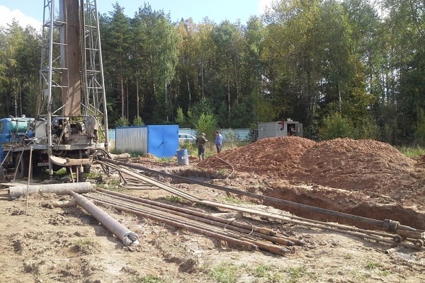
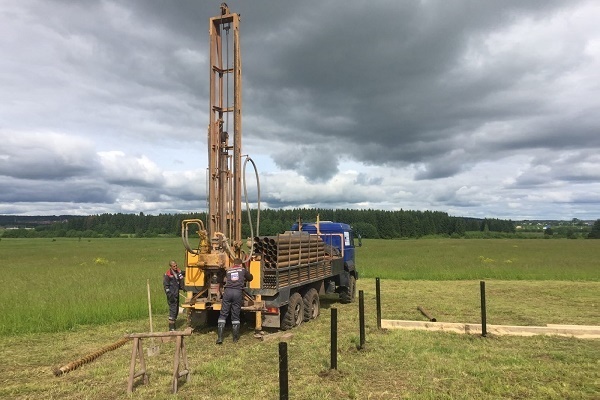
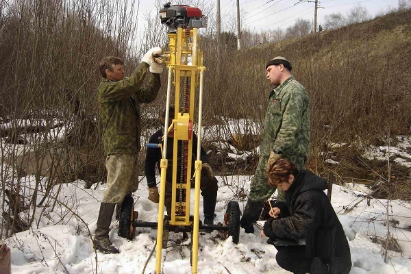
Exploration Drilling
This method allows you to accurately determine the geological formations forming the site. But since it involves large financial costs, it is used only in situations where it is planned to equip a large water intake designed for several houses.

Specialists distinguish three methods of exploratory drilling:
- Column - it is applied when drilling to great depths. The principle of operation is based on the fact that a rotating core pipe, the end of which is equipped with a drill bit, cuts through the rock. And then the destroyed rock is pushed to the surface under the pressure of the flushing solution or compressed air supplied through the pipe string.
- Rotary - based on the transmission of rotational motion to the drill string through a surface rotor. This type of drilling is accompanied by flushing the bottom of the rock with a special solution or plain water.
- Shock rope - works due to the destruction of rocks under the influence of a falling drill, the end of which is fixed on a rope. The tool simply breaks off the rock and grinds the soil, and then with the help of a chipper, it extracts it to the surface.
Choice of drilling method and drill depends on the type of rock, the depth of the reservoir or lens and the financial capabilities of the customer. But in terms of drilling speed and productivity in this regard, rotational methods win.
The price of an exploratory well is determined by multiplying the cost of one running meter per barrel depth. The total amount is calculated based on the complexity of the penetration, the diameter of the barrel and the need to use casing pipes.
Hydrogeological data obtained from drilled wells are taken into account when preparing a forecast estimate of the prospective area. They help to study the change in the properties of water-bearing rocks in a vertical section.
DIY well drilling
But drilling exploratory wells is a fairly expensive method. Not many owners of suburban areas can afford it.As an alternative, test drilling can be performed independently using the screw method.
This method is similar to making holes in the ice during winter fishing. The helical structure is simply screwed into the ground. When removing the auger blades to the surface, the crushed rock is taken with them.

For work, you need a screw with blades, equipped with a drill head. You can buy such a screw tool in any hardware store. Included in it are typesetting rods, which are convenient to use to build up the structure as it goes deep into the soil.
The work is performed in the following sequence:
- At a selected site, a guide pit is excavated with a depth of 60-80 cm.
- The auger is lowered into the pit and begin to rotate, deepening the drill head.
- After the screw rod has passed 1-2 meters deep into the soil, a drill is removed, removing the loosened earth. As the helical structure advances, it is important to monitor the vertical position of the well.
- When the auger reaches a depth at which it is already inconvenient to work with the tool, the structure is expanded with a drill rod. Simultaneously with the implementation of drilling under the action of centrifugal force, casing of the walls of the well occurs.
- Drilling is performed until the helical shaft reaches the aquifer.
The excavated soil is transported using the same screw, which is a single screw conveyor, to the surface. At the same time, the soil being raised outward due to the friction force strengthens the walls of the trunk. This allows you to reduce costs when drilling plastic soils, since there is no need to use casing.
But it is worth considering that the auger method is effective only when searching for groundwater, the level of which does not exceed 50 meters, and the rocks belong to the plastic and loose category.
Popular ways of determining
Do your own exploration in search of an aquifer for shallow drilling or needle wells, even if there are no landmarks in adjacent areas.
Natural orientation
Signs of the presence of an aquifer in the soil can be:
- Observation of the behavior of animals and insects. Pillars of midges curl in the place where there is a source of water, and red ants, on the contrary, try to settle away from it.
- Large distribution in the district of hygrophilous plants.
Nettle, horsetail, sedge, sorrel, reeds are indicators of the proximity of groundwater from herbaceous plants. Tree-like plants with a stem root such as bird cherry, willow, birch, black poplar, sarsazan will indicate that the water lies at a depth of up to 7 meters.

The soil and its underlying rocks, under the thickness of which the source passes, is characterized by increased humidity. It will certainly evaporate, forming in the morning clouds of fog; you just need to observe the terrain.
Pay attention also to the relief. It has been observed that water carriers occur almost horizontally. Therefore, in the area of depressions, the probability of occurrence of water is always higher.
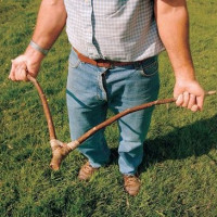
Using dowsing frames
The ancient method based on the biolocation effect, in which a person reacts to the presence of water and other bodies in the earth, creating heterogeneities of various configurations and sizes in its thickness, does not lose popularity.
When searching for water to select a place under water well on the plot in a biolocation method, the pointer is a wire frame or a branch with a fork in the hands of a human operator. It is able to determine the presence of an aquifer, despite the soil layer separating it from the water.

Dowsing frames can be made of calibrated aluminum, steel or copper wire with a diameter of 2-5 mm. To do this, the ends of the wire segments 40-50 cm long are bent at a right angle, giving them an L-shaped shape. The length of the sensitive shoulder will be 30-35 cm, and the arms 10-15 cm.
The operator’s task is to ensure the free rotation of the “tool”. To ease their task, wooden handles are put on the bent ends of the wire.
Bending your arms at a right angle and taking the tool by the wooden handles, you need to slightly tilt them away from you so that the wire rods become like an extension of the hands.
To achieve the goal, you need to consciously tune in and clearly articulate the task ahead of you. After that, you only need to slowly move around the site and observe the rotation of the frames.
In the place of the plot where underground water is hidden, the frame rods cross each other. The operator should mark this point and continue research, but already moving in a perpendicular direction relative to the original line of movement. The desired source will be located at the intersection of the found marks.

It is believed that the best time to search for water through dowsing is summer or early autumn. The most favorable periods:
- from 5 to 6 in the morning;
- from 16 to 17 days;
- from 20 to 21 pm;
- from 24 to 1 am.
L-shaped frames are convenient to use in the field, but in the absence of wind. To work with the tool you need experience and skill. Indeed, the deviation of the frame may even depend on the emotional state of the operator.
For the same reason, before working with frames, it is better to refrain from drinking alcoholic beverages. Before you begin the search, you need to learn how to work with the radar and "hear" it. Due to this, in the process of searching for water for the well, the operator will not be distracted even by the presence of closed water pipes on the site.
But it is worth noting that folk methods cannot give a 100% guarantee of obtaining the expected result. After all, even with a successful outcome, there is always a risk of getting water well with low productivity.
Conclusions and useful video on the topic
Tips for beginners, how to determine the place for the arrangement of the well and drill it yourself:
Probe exploration drilling:
It is worth approaching such a crucial event as the search for water for a well in all seriousness, using modern exploration methods for this purpose, or else entrust this work to professionals.
Want to tell how you chose a place for drilling a well in your own area or ask a question? Please write comments in the block below. Here you can also discuss with us and site visitors if you do not agree with the information provided.
 How to find water for a well: an overview of the most effective ways to find water on a site
  Do-it-yourself deepening of the well: a review of the best methods to get to the aquifer
 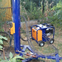 Do-it-yourself water-boring for water wells: a review of technology
  Do-it-yourself water well setup: how to properly equip a water source
 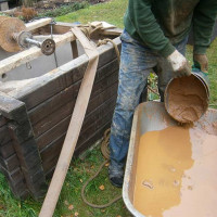 Do-it-yourself well cleaning: a review of the best preventative and capital methods
 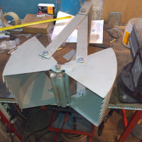 A review of the best tools for cleaning wells and how to use them
  How much does it cost to connect gas to a private house: the price of organizing gas supply
  The best washing machines with dryer: model rating and customer tips
  What is the color temperature of light and the nuances of choosing the temperature of the lamps to suit your needs
  Replacement of a geyser in an apartment: replacement paperwork + basic norms and requirements
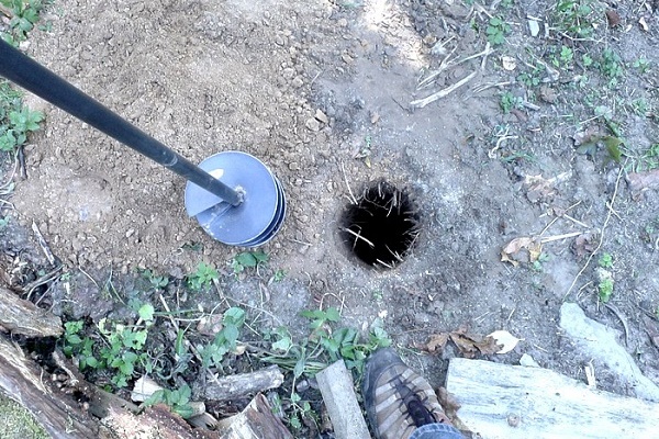
Recently I planned to drill a well under water, as carry water home far. In addition, it takes a lot of time, and there are a lot of inconveniences. But this venture is not cheap.In order not to get into trouble, he obtained information about the occurrence of water in a local drilling company. Although before that he relied on the folk method, saying that where burdock grows, there is water. But it turned out quite the opposite. I recommend everyone, do not invent a bicycle - find out information from specialists.
I will argue with the previous comment, and here's why. I also did not trust folk methods. But after the mother-in-law in her house correctly determined the place for the well, she changed her mind. She did this with the help of willow.
Willow is believed to be very sensitive to water. She used a willow branch with two ends (like a slingshot). I did not make a slingshot, namely, that the branch itself had such a shape. The length of the ends is 15-20 cm. She held with her hands at the two ends, and with the thick end forward. In the place where there was water, this end began to lean down. It is advisable to hold the branches not with your hands, but insert them into some sort of holder. In our case, it was a ballpoint pen case.
Dear Natalia. Your statement is complete nonsense. You simply cannot imagine the area of an aquifer in a plan. Believe me, this is much more than a few square kilometers, most often tens and hundreds of km². And you with the mother-in-law go with a twig on the site, as if looking for a little egg with gold. If you think that your water is really at one point, then why bore a well for its production? You’ll deflate it all at once.
The aquifer is either completely beneath your summer cottage or it is not there, i.e. most likely it lies at too great a depth. What is there to search for six hundred parts with a slingshot? Go to the neighbors, find out if they have a well or a well, at what level the water stands, and order drilling by choosing a place that is CONVENIENT for subsequent operation.
Dear Alesia. You are right, but not quite. I myself am engaged in drilling and finding water using dowsing. The fact is that the surface of the earth, as well as aquifers, are not smooth as a chicken egg, but as a result of the movement of the earth's crust and glaciers, as well as many other reasons, they have taken the form of wrinkles. And like a human body, sweat protrudes all over the surface, but drops flow down precisely these wrinkles, which many drillers call water veins.
And any movement (of a person, electricity, wind, water ....) creates electromagnetic waves, which affect the frames or the vine. Therefore, I do not take up the wells, if I do not find such a vein. Since there is either little water in this place, or it lies at great depths.
Dear Peter! You are completely wrong, absolutely nothing. Please do not search for water using dowsing, do not fool people.
What are the “wrinkles” of aquifers? Wells for private traders are drilled in a quarter. These are sedimentary deposits that "settled" on the ancient relief for billions of years. There everything is approximately horizontally oriented with slight deviations.
What, damn it, vein water ?! Is it gold, or what? Underground water occurs in only two ways: it occupies pores and voids in the Quaternary sands / galiches / gravel deposits or condenses in cracks formed in rock formations. All.
Alesia, a specialist worked for me at the site. In the place where the grandfather had an old well, from which there had been no trace for many years, a man with a frame said that the water was salty (the grandfather confirmed that it was so - the well was filled up because of the salt in the water). After which a place was found "here the water is good and there will be no end to it." As a result, the water in the well is really good and you can pump at least for days.
Here they are, these aquifers and the wonderful science of geology. By the way, a neighbor has a quicksand instead of an aquifer at the same depth.
Another case, in Lviv, Rostov Region, Oryol Region, there were old wells. Before the war they dug them. Water became scarce - geologists arrived (in the 80s it was). We drilled drill, sand and tyrsa more than 100 meters.So they did not find water. Then in two thousandth they found water and made a well. And those wells are now with water.
Pavel, I apologize in advance for the harshness of words, but you cannot be so dense in the 21st century!
Which specialist with the frame? You would have called a shaman with a tambourine - he would have told you no less “about the secrets of nature”. Yes, and spells of a thread I read. What are you? All these frames are flyers for uneducated people to cut more dough from them. Estimate, what if this “specialist” has a hangover, his hands just tremble, you’ll drill where he has tremor?
All these tricks with frames have long been refuted. But dowsing is still trying to look for karst cavities in rocky rocks in the middle lane. Just a difference in density in the upper layers of the cortex can really be detected. Not the fact that they have water. These types of “technology” have nothing to do with hydrogeology.
And yes. They buried a well with salt water? With mineral? At your site? And they could just get rich on its production) Unless, of course, it was someone who “joked” over your grandfather so evil and stupid.
Tyrsa 100 m from the surface? Did someone dump mountains there, or what? It must be when the Black Sea was digging, the dump was brought to your village 🙂
Water is not gold, it is everywhere. In private areas of 6 acres, it is everywhere at approximately the same depth, there may be a difference of 10 cm. You just need to choose the most convenient place for drilling the mine and its subsequent operation. If you had a land plot of 100 hectares, you could walk around with frames and with a smart look for your own comfort, pretending to be looking for something. And on such a patch of land it is pointless.
Pavel, tell me, is it possible to somehow get around a quicksand? The fact is that we have already drilled a well for 4 times on the site and everything is in vain - we reach 15-20 m and the quicksand draws everything in.
Even casing pipes do not go any further, we only give money to people for work and that’s it! What is the most effective way to find water? Tell me please!
The best way to get around a quicksand is not to drill at its location. I’m just wondering how you chose a place for a well for water, if the fourth time you fall into a quicksand?
If the place under the well is chosen by the same people who drill it, then this is not your problem anymore, that they are the fourth time they fall into a quicksand! You should pay for the fact of the work done, and not for the number of failed attempts. It seems that people use your incompetence and try to, forgive you, breed for money.
I work in this area and such “specialists” are rare, but they are found. I also get to quicksand, but very rarely, we have our own methods for dealing with them and passing this section. So far there has not been such a quicksand that would force us to drill a new well.
Hello. Maybe tell me something sensible ... Because my site collected everything: quicksand, and at 9 meters swamp, and 15 meters, the installation simply could not break through some layer (dolomite), as the driller said. There was something black coming (I jokingly said that oil). I'm waiting for some more experts ... already 3. They say that with their installation they will definitely drill everything, but there is a possibility that the contents from the swamp will fall into the lower layer through the space between the pipe and the rock.
Went with a wire)) HOW ALL ALL METHODS ARE SPEAKED ALREADY. Where they drilled - nothing, really crossed in several places ... I checked 5 times ... What can you advise, where to look and what to drill with? And what could it be?
Another of my observations - there is a difference in the area - I think these are the so-called quicksand borders, but maybe I'm wrong. Nearby there is a river and wells. Thanks in advance.
Let's try to figure out the situation. Regarding how to get around quicksand, as I wrote above, there are ways:
1.Shock-rope method, when they drill a special impact machine inside a metal pipe;
2. Abyssinian well - this method involves driving a pipe from the surface, diameter 2.5 cm, to a depth of 20 m.
Now about the black liquid. Since you write that there is a swampy area nearby, then most likely it is silt deposits that fell into groundwater, for example. Their danger is that they can clog water in the well. But then again, the casing is for this purpose done in the well in order to avoid such contaminants.
About the dolomite. Yes, it’s not a problem to drill it, three things are needed: drill, experience and time. It’s just that now many have a business for later, everyone wants to make a well in a day, get money and goodbye. And sometimes you have to drill dolomite at a speed of 1 m in 4-6 hours. Personally, I have never had such a fact that our team came to drill, stumbled upon a boulder, quicksand, dolomite and so on, we say that this is impossible and curl up. Look for normal specialists who will give you the result in the form of a finished well!
Hello. I will speak about dowsing. In fact, it is also effective how to call a water mage and ask him to look for aquifers. So even take 3 dowsers with experience, put them on one site and all 3 will show different points.
Organizations like “horns and hooves” offer the services of experienced dowsers, but even there they say that the success of such an event is 50%. That is, an accident. There is nothing scientific in this way.